Kodachrome Basin Handprints
Cannonville, Utah, United States
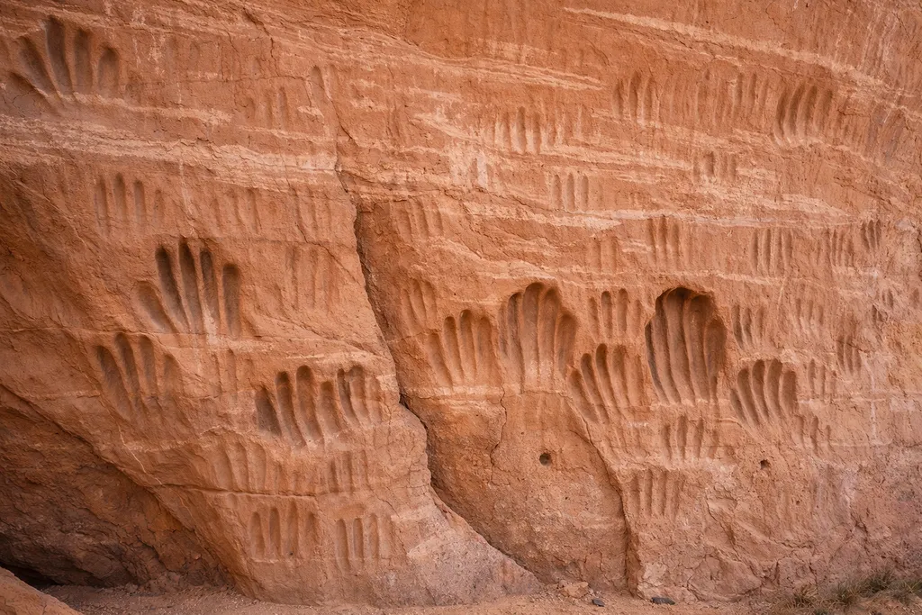
A small rock shelter off Kodachrome Basin’s Panorama Trail contains 100+ hand-shaped grooves (petrosomatoglyphs) rubbed into friable Entrada Sandstone; age and authorship are debated.
Claims about Kodachrome Basin Handprints
- The age and authorship of the handprints are not established
- Alternative hypothesis: the handprints are ancient Indigenous ritual marks (disputed)
- Friable Gunsight Butte Member sandstone makes hand-imprinting plausible
- A Panorama Trail shelter contains more than 100 hand-shaped grooves
- Alternative hypothesis: some ‘handprints’ could be natural cavities later emphasized (disputed)
- The grooves are described as petrosomatoglyphs formed by repeated hand-rubbing
- Management tension: access vs preservation for a touch-sensitive site
- Kodachrome’s sandstone ‘pipes/spires’ have competing origin explanations
- Trail erosion and shifting ground level complicate contextual inference
- Modern visitors are likely deepening at least some grooves
Evidence
- Critical travel/field note: emphasizes uncertainty and discourages overconfident origin claims
- University-hosted thesis on Kodachrome clastic pipes (context for competing models)
- UGS access description from Panorama trailhead to shelter
- UGS GeoSights field article describing the handprints and setting (2024)
- UGS measurement: lowest handprint height above ground
- UGS explanation: frictional hand-rubbing dislodges grains and deepens grooves
- UGS note: visitor touching likely deepens grooves ("statue rubbing" analogy)
- UGS observations: spalling/weathering patterns and mixed surface textures
- USGS Geolex: Gunsight Butte Member (Entrada Sandstone) definition
- Trail blog references "Entrada Sandstone Handprints" as a named stop